
I had the best guided hike to Bukit Lanjan courtesy of fellow blogger / hiker Janstu who shares that the trails literally ‘start from my front door, so to speak’.
For a comprehensive background on Bukit Lanjan and its development todate, be sure to read Janstu’s blog here, including how the recently opened Community Trails came about.

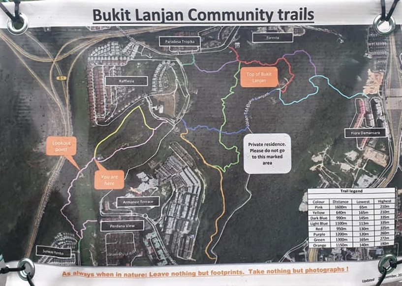
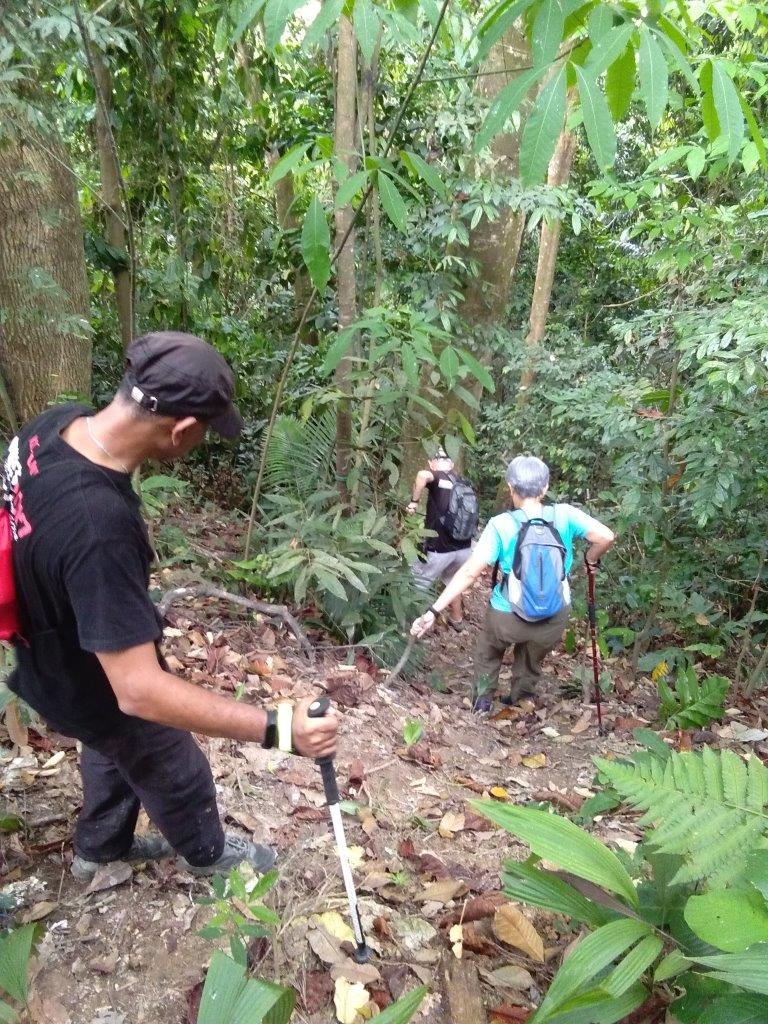
Going anti-clockwise, our hike started with a road walk from Armanee Terrace Condominium towards Rafflesia Homes before punching into the forested area on the right.
Following the ‘Dark Blue Trail’ to Lanjan Peak (as indicated on the Map), we climbed steadily for 45 minutes.

Proceeding at a comfortable pace, we were surrounded by nature sounds ranging from the shrill drone of cicadas to the louder calls of monkeys.
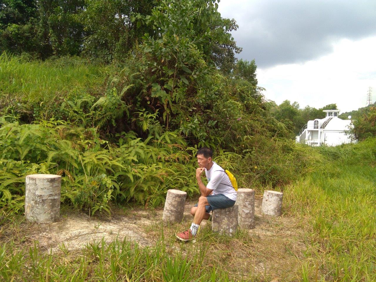
Along the way, we stopped at Jan’s favourite tree for a picture, of course.
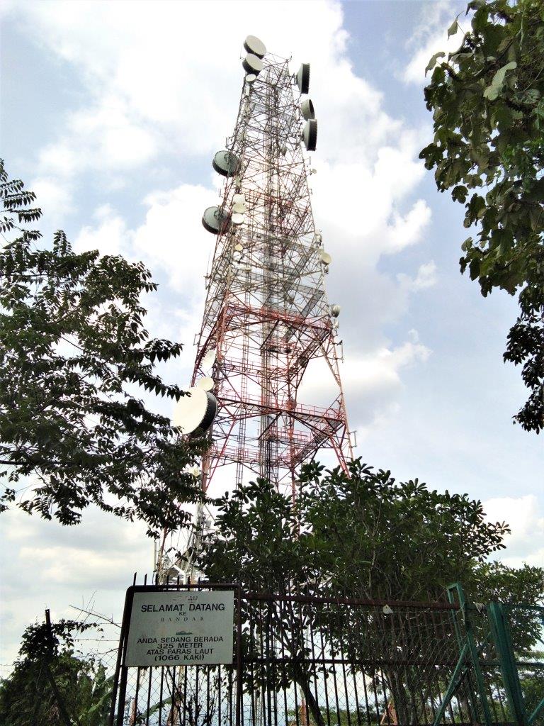
The trail eventually plateaued out, joining a tarmac road leading to the TM sub station.

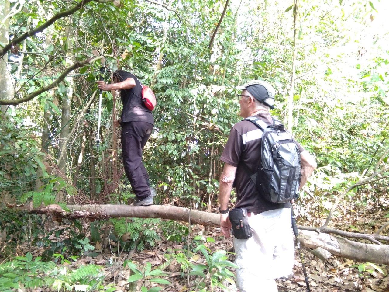
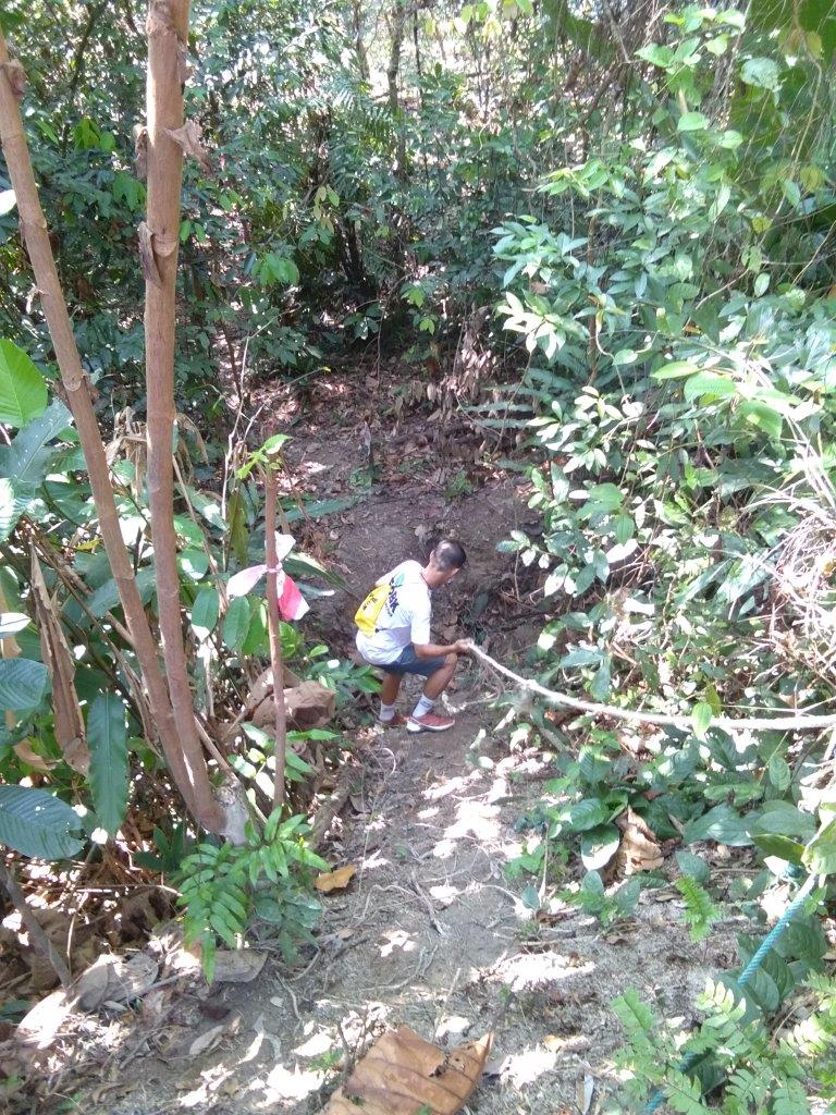
Though the peak is just five minutes away, the final portion involves climbing up a near vertical slope and walking on a suspended tree trunk. Even with a rope, getting up the slope required some nifty arm and foot coordination. The final challenge was a balancing act on a trunk.

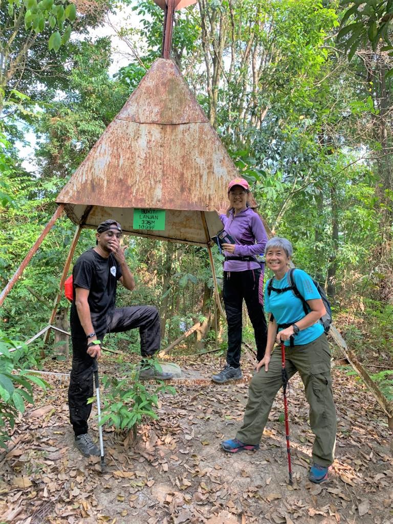
Having reached the 335m peak, we were disinclined to linger as it is a small area with no view. The more compelling urgency was the thick swarm of mosquitoes waiting to feast on us. We bolted.
Mission accomplished, we continued our circuitous route along the ‘Red & Purple Trails’ which led us up and down with some occasional flat stretches.


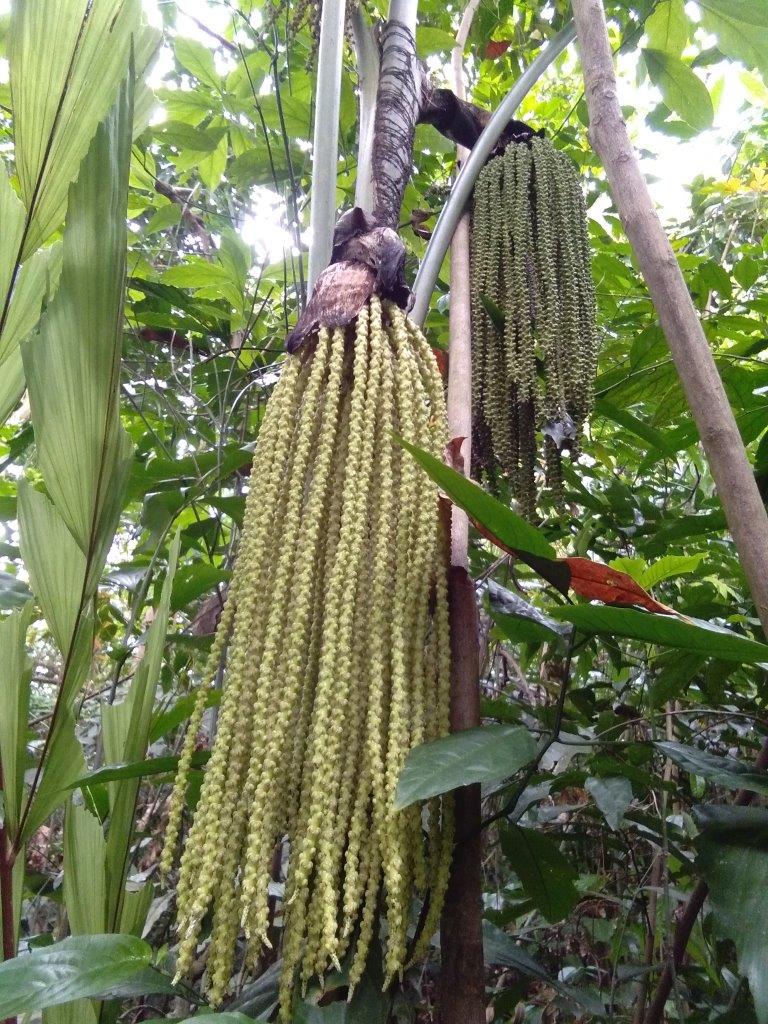
Besides a good cardio workout, here are some interesting plants that caught our attention.
Clockwise from top left : fishtail palm, and fruit, salak fruit, kelumpang burung (Sterculia parviflora) open / unopen capsule, and close-up.


While descending on the ‘purple trail’, I had just commented to Jan that I’ve not seen any bat lilies (left), and suddenly, there they were – right in front of us. Also spotted was a grove of yellow bamboo and a unique red plant.


After 2.5 hours, we emerged on the road once more, closer to the Sri Damansara end. The slight incline makes this road popular for running, walking the dog or simply enjoying the outdoors.


Rare Viewpoint
I also wanted to retrace my previous hike route (May 2015) along the open green slope beside the transmission lines. You can read about it here.
On a separate occasion, starting from the trailhead at Sunway Rymba, we discovered some side trails (colour coded Pink & Yellow on the trail map) that weaves along the edge of the forest. We ducked under the forest cover and let the path lead us to wherever it was headed.
Due to the dry spell, the well-marked trail was heavily carpeted by dry leaves, as it wound up and down with rope support at the steeper sections.


The final uphill was hot and tiring. Bereft of trees, the knee-high lallang was dry and slippery with no hand holds whatsoever.
I had some anxious moments as I kept slipping back two steps with each step forward.
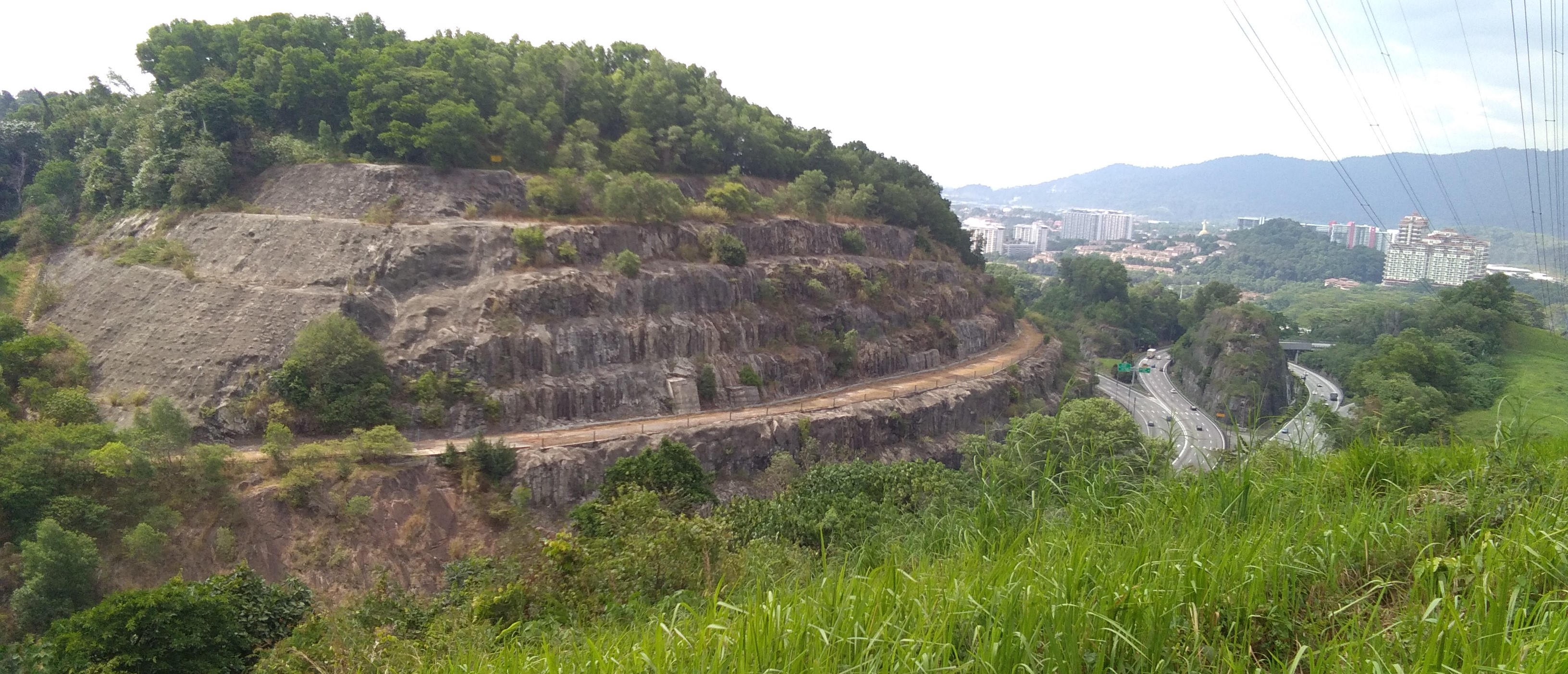
The spectacular vistas from this vantage point makes all the hard work worthwhile.
Directly opposite on the other side of the North Klang Valley Expressway (NKVE) is Unity Peak of Kota Damansara Community Forest (KDCF). My all time favourite is the island rock that splits the northbound traffic on the highway.


From the lookout point, we turned east and easily connected to the road at the water tank. Back in 2015, it was still a work-in-progress in the middle of a barren landscape.
Rafflesia Homes water tank in 2015 (top) vs 2021 (bottom) and access road (right).


With a network of trails of approximately 9km, Bukit Lanjan provides a much welcome green space for the community. Sadly, it sits on private land and the owner does not like people trespassing.

Just recently, barbed wire had been placed at the trailhead to deter people from entering.
I echo Janstu’s sentiment and wish that the trails remain accessible to the community.
